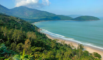
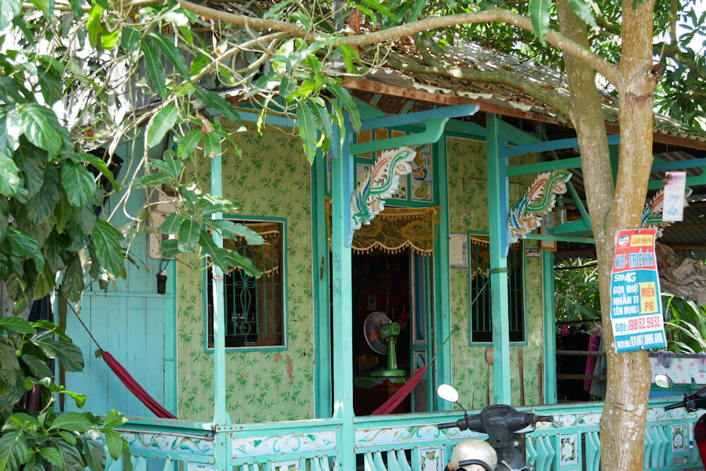
Classic canal paths and colourful cottages
This day two leg of my DIY touring route through the Mekong Delta veers inwards from the Cambodian border but remains in a region strongly coloured by Khmer culture.
Cruising, rather than speed, is order of the day as you stick to cosy canal roads. Bank on covering relatively modest distances but enjoying plenty of pastoral scenes along the way.
While this route forms day three of my Mekong Delta Cycle Route, you could just as easily use Chau Doc as a starting point: it would be a matter of putting your bike on a long distance bus from Saigon.
Route info
Day: Three of five
Distance: Around 70-75 kilometres over one day, or 30+ kilometres split over two days (overnight in Phu ).
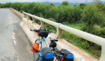
Terrain: Flat, with two ferry crossings
Highlights: Colourful cottages and shady canal paths
Watch out for: Midday heat passing through urban areas at Phu My and Cho Moi. Accommodation options are limited on Gieng Island so book ahead.
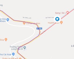
Map
Introduction
This is an absolutely fantastic ride that will show you the very best of the Mekong Delta, the side tourists almost never see.
It is very flat, but do keep in mind that the 70 km distance is a relatively long ride in the steamy southern Vietnamese climate.
If you’d prefer to break the journey into two shorter days, the place to do it would be the nice little town of My Luong, where there are guesthouses aplenty.
My own plan to cover as much ground as possible during the morning were thwarted by just how pretty the first phase of this ride is.
I just couldn’t keep myself from stopping every five seconds to take yet another photo of a gorgeous wooden house, gaping at the canalside villages which look like something out of a very exotic storybook.
Heading out of Chau Doc
The city of Chau Doc – easily accessible through Vietnam’s long distance bus network – also makes an excellent starting point for bicycle travels in this part of the world.
Head off early as you can ahead of a full day’s cycling, making the most of the cool, fresh morning air.
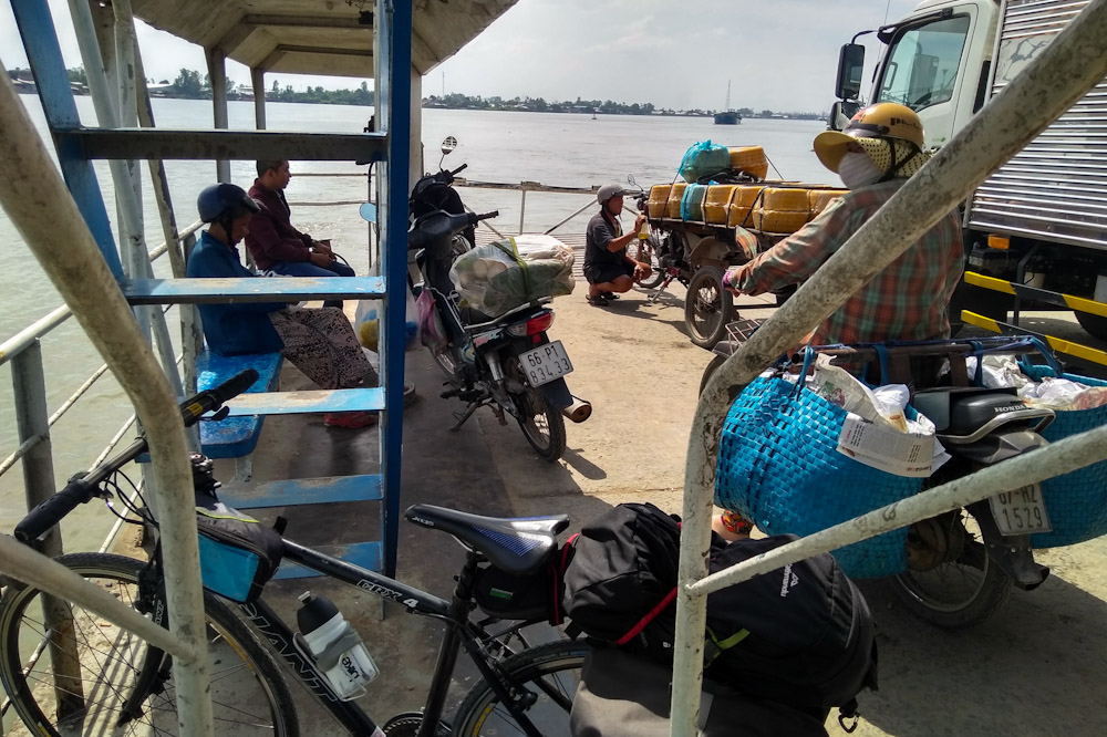
Once over the bridge from central Chau Doc (see my guide for accommodation options nearby), getting to the ferry should be quick and easy; that said keep an eye on your google maps so as not to miss the turn off – it’s down an unsigned dirt road.
Ferries shuttle back and forth all the time, and the longest you’re likely to wait is five minutes or so. It’s good to have some small change handy (2K) to buy a ticket on board.
Once the ferry docks, walk your bike off and take a right turn down DT 953. This busy street is lined with food stalls and a good place to grab a fresh baguette (banh my) or bowl of noodles for breakfast.
Exit off a left-hand turn and all of a sudden you’re on a smooth quiet rural road, where signs of the city are quickly replaced by fields. Apart from some unsightly rubbish dumping it’s a smooth and pleasant enough ride.
Back road heaven
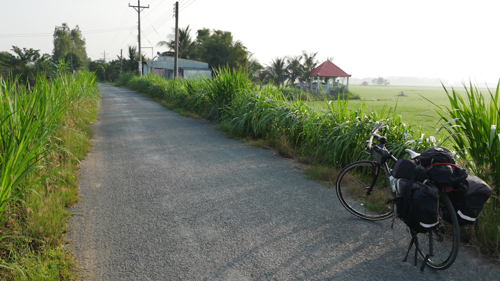
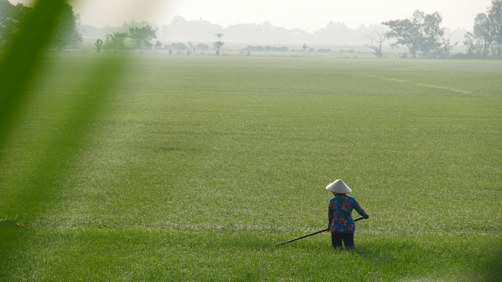
My back road route diverges from the Bassac River at Hoa Lac village, taking you up a small but decent canal road through sweeping carpets of rice fields.
In the early morning light it’s a serene vista.
The crossroads at tiny Phu Long village marks the start of one of my favourite cycling stretches in southern Vietnam, a long, straight 17-kilometre canal road running south east
For me, this is what I dreamt of when conjuring up Mekong Delta cycling in my imagination: shady unhurried canal roads adorable wooden cottages and river life going by.
Wooden barges pass under impossibly quaint wooden bridges shaded by palm trees.
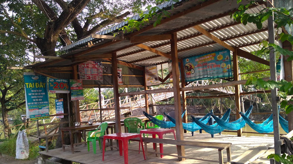
Casual riverside cafes are a great place to enjoy some well-deserved hammock time and catch some breeze off the water.
Eventually the canal (Kenh Thanh Nong: the word ‘kenh’ meaning canal) reaches the small town of Phu Hung, where a random tangle of roads converges.
A minor pagoda here is a good spot to escape the confusion for a minute and get your bearings.
There is a smattering of light industry along the northern bank of the canal (people do have to make a living after all) but the setting is still very idyllic. I loved it.
For the record, I’ve marked a key bridge crossing near Phu Hung that does not exist in Google Maps. It is there, you’ll have to trust me on that one.
Phu Hung to Phu My
From Phu Hung there is another delightfully shady and attractive canal road here that leads due east towards My Luong and the next ferry crossing.
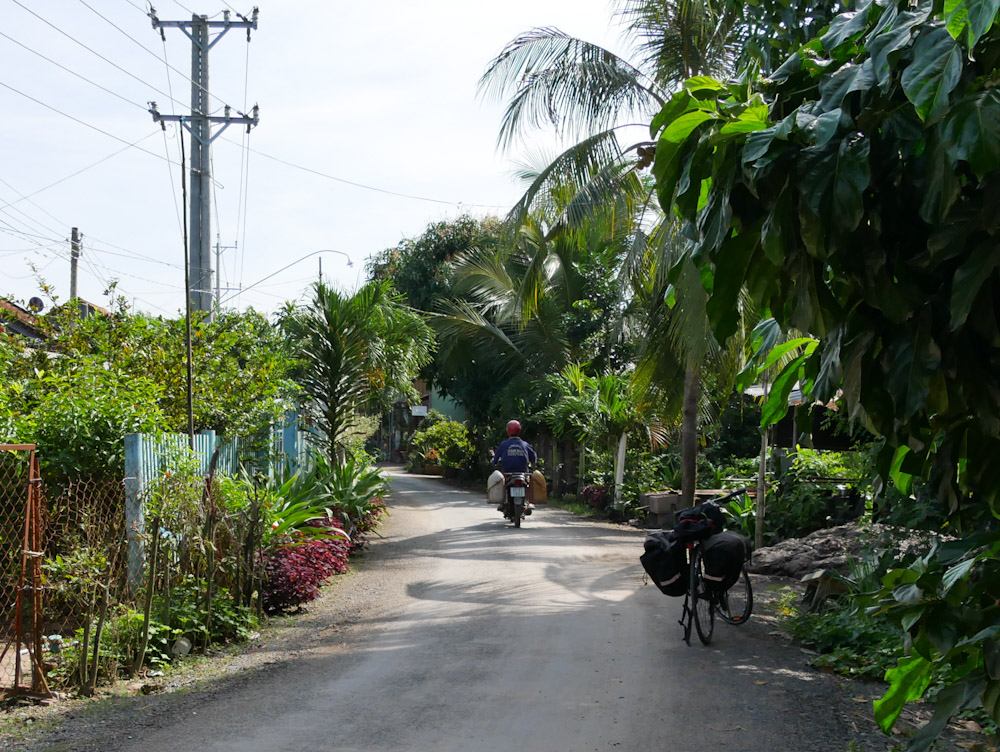
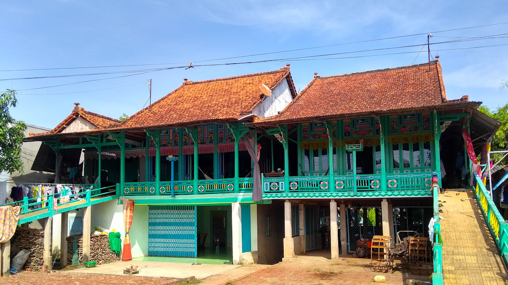
The decorative wooden houses here are not old (most are marked 1995) but exceedingly pretty. This is definitely not a section to rush over, and you’ll want to keep your camera handy for sure.
The town of itself is relaxed and likeable, and a good place to stop and have lunch, or even to stay the night.
Another option would be to see out the heat of the day by finding a guesthouse that rents rooms by the hour. Ok, it sounds a little dodgy but in Vietnam it’s quite normal for people who travel for work to see out the hottest two or three hours of the day in this way.
It would also be possible to bypass the town altogether en route to the ferry crossing, where you’ll find plenty of snacks for sale – see my map.
Local market lunch
The town’s specialty dish is noodles with fried meat (Bun thit sao) so you’ll see numerous street food vendors along the road into town.
Since I arrived in My Luong on a blazingly hot day, I decided to seek out some relief in the cool undercover market.
There, I managed to scope out a little stall selling bowls of wide rice noodles topped with herbs and beef stir-fried with lemongrass and peanuts. It was a matter of pointing and hoping for the best – but this still stays in my mind as one of the most authentic and delicious meals of my trip.
Thuan Giang Ferry
The ferry station is only about a fifteen-minute ride from the market at Phu My. Once again it’s a very short wait, and the system for queuing and boarding is orderly and straightforward. Tickets cost 2000 VND
On the far bank, a convenient turn lets you make a quick exit off the main street to continue along another (thankfully shady) canal street.
It hardly seems possible, but the houses along this stretch are even more adorable than the ones before, intricately carved and painted.
I’m completely head over heels in love with this area, but it’s all over too soon, with the quaintness quickly replaced by urban reality at the town of Cho Moi.
It’s all a bit of a shock to the system, but stick to DT946 and you’ll soon find yourself out of town, and cycling alongside a broad river.
Or, if you’re in need of a place to eat, drink or chill, you’ll find a good strip of modern cafes and a few restaurants at nearby Nguyen Huu Canh.
Surprise – a river!
Although a sizeable river weaves its way through the landscape, for some reason it is missing off Google Maps’ standard view.
If you can, cycle along the riverbank. Or, if you’re looking for more shade or village vibes, it’s possible to take smaller back roads for some of the way.
Alternative roads
The day I cycled this route was by far. the hottest day of the week. I battled with the direct sun, especially in the section from Phu My to the ferry, and through Cho Moi.
As mentioned, on a day with a nice bit of cloud cover, it would be very pleasant indeed to follow the road along the south side of the river.
In my case, desperate for shade, I turned north east onto a canal road. Its breezy and pleasant if a little boring compared to what’s gone before.
What I did find here was a waterside cafe which let me collapse into a hammock for a couple of hours and watch Croatian soap operas with the family.
From there, it was a matter of making it to the main road. The 20-minute cycle along DT942 brought me uncomfortably close to a few heavy vehicles, but wasn’t dreadful by any means.
Vinh Long
Whichever road you take, you’ll need to pass through the town of My Luong to make the crossing over to Gieng Island via the My Luong bridge.
There’s the usual long thoroughfare lined with shops leading into a slightly messy market area, but eventually you’ll reach the bridge to Gieng Island.
Like a portal to another world, the bridge will take you into a quiet and charming part of the Delta, where mango trees drip with fruit.
There you’ll find a wonderful homestay – the real deal – staying on a little known island in the Mekong Delta.
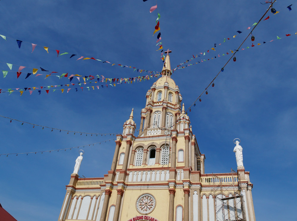
If you have a little energy for sightseeing, turn right after the bridge and make a quick stop at the historic and cheerful Cu Lao Gieng cathedral, possibly the oldest French colonial church in South Vietnam.
Read more:
A genuine homestay experience: staying on Gieng Island